NOTE: I found this post in my 'drafts' pile, where it had rested for a few years. I don't know why I didn't post it then.
Today's trip, however, will offer little for intrepid cyclists. The weather threatened rain all day, and in fact rain was forecast for the afternoon. It didn't arrive until evening but the day was at best cloudy and frequently cool.
Most of the ride, I didn't dally for photos, but just got the distance in. Which is too bad, because Gangneung has a few interesting sights that I rode on by.
Anyway, here are a few photos from today plus a handful from previous trips to points along the way. You will notice that my clothing changes, the season changes and even my bike changes from shot to shot.
I know some good alternate routes for the route from Sokcho to Hajodae and may show them the next time I post a map. Most of my trip today was on Highway 7 and most of my pictures from today are of my misadventures resulting from leaving highway 7. There are a few good places to ride through villages to get off the highway but none are very long. That's too bad because the highway lacks a paved shoulder in quite a few places. I felt safe but only because the road was not particularly busy.
Heading south on highway 7 from Sokcho, I stayed on the highway until I reached Naksansa. From the temple, I was able to hug the coastline for about 10 km.
About 2 km from the temple, I crossed the Namdaechun (a river) and a few km after that, I passed Osanri Prehistoric site. Don't bother hunting for it. There is an english sign but it just says that items were found here and taken away. There's nothing to see.
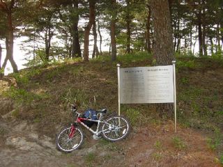 Osanri prehistoric site, nothing to see here.
Beyond that is a sign for a beach. It's a great beach but the road is a dead end.
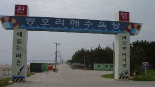 deadend
If you are feeling real tough and have something to prove, try playing on the meanest volleyball court. Look at those stones!
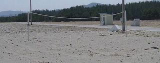 bad-ass volleyball court
The road runs below the Yangyang airport. Here is a shot from the airport.
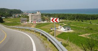 Airport view
Eventually, the backroad reaches the highway. In the interests of helping my readers, I tried to stay on the back roads. Here, I cross some drying nets; they're everywhere along the coast. I saw tracks deforming the nets so I felt secure walkng over them.
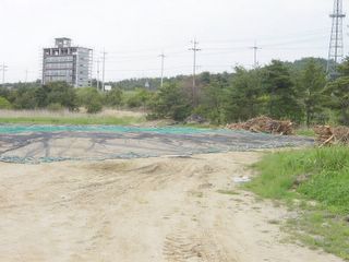 backroad, beginning of trouble
Here is the first place I had to walk. The trail was passable by mountain bike but not by road bike.
 walking 1
Hajodae is a pleasant scenic site, one of the gwandong (8 special sites), my university is named for.
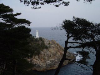 Hajodae lighthouse
From Hajodae, I stayed on the highway until Dongsan, where I was able to ride through the village for two or more km to Hyu-hyu-am. The villages were nice, but the road is not suitable for speed; expect a sightseeing trip not a race.
Hyu-hyu-am is a hermitage, or small temple based on strangely shaped rocks on the coast. It's a pretty and quite famous site here.
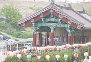 Hyu-hyu am
 hyu-hyu am
I then rode on the highway to the interchange with toll highway 50. I followed a new, multi-lane road to the beach and found about 200m of great road. Then...
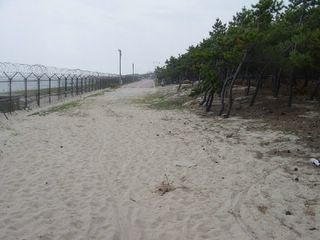 Walking 2
I walked my bike again and reached a paving stone road that went past the Gangwon office of the Sea Explorers of Korea, a Korean version of Sea Scouts. In the early summer, they have a festival weekend where you can play on their toys and boats.
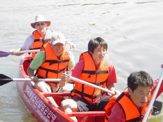 Sea explorers of Korea
The paving stone road continued to Jumunjin and this...
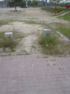 walking 3
After Jumunjin, I stayed on the highway. I rode through Jumunjin and lost two screws on my bikerack. A kindly welder found some screws for me and I was again off.
There were some good sites between Jumunjin and Gangneung but the day was getting colder and darker. I will take further pictures on the return trip later this week. The trip from Sokcho to Kwandong University in Gangneung took three and a half hours and was 70km long.


No comments:
Post a Comment